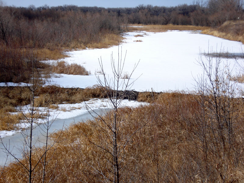
Fort Union Information
| Wetland Category: | Open Water | |
| NWI Classification: | PUBHhb |
| Latitude: | 47.9944 | Longitude: | -104.0307 |
Image Data |
||
| Date: | 02/16/2008 | |
| Direction: | West | |
| State: | North Dakota | |
| Country: | USA | |
| Location: | At Ft. Union National Historic Site, at the south edge of the confluence of the Missouri and Yellowstone rivers | |
| Author(s): | Larry Handley | |
| Affiliation: | USGS, Mid-Continent Geographic Science Center | |
 02/16/2008 |
|
Description:
Palustrine water body. Less than 20 acres in size. Impounded by beaver dam in foreground. Water presence is considered to be permanent. |
||
|
Conditions: Ponding on the floodplain of the Missouri River. Wetland scrub-shrub of small willow surround the water body. The water body occupies a swale between a river meander sand ridge and the bluff. |
||
|
|
||
| Disturbances: Beaver activity is evident from the constructed dam. | ||
| Comments: |