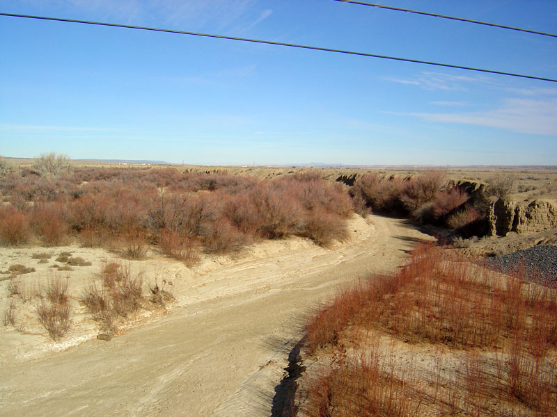
Rio Puerco Information
| Wetland Category: | Streambed | |
| NWI Classification: | R4SB4J |
| Latitude: | 35.034455 | Longitude: | -106.942002 |
Image Data |
||
| Date: | 12/16/2005 | |
| Direction: | North | |
| State: | New Mexico | |
| Country: | USA | |
| Location: | Rio Puerco north of I-40 | |
| Author(s): | Larry Handley | |
| Affiliation: | USGS, Mid-Continent Geographic Science Center | |
 12/16/2005 |
|
Description:
Rio Puerco streambed is an intermittently flooded riverine channel during the spring from snow melt and after localized rainstorms. It is a dry streambed for most of the year. Sand is the dominant sediment type available in the streambed. |
||
|
Conditions: No water present in the river channel. Leaf-off of the woody scrub-shrub willow on the sandbar adjacent to the streambed. |
||
|
|
||
| Disturbances: None evident in the image. | ||
| Comments: |