White River NWR Information
| Wetland Category: |
|
Forested Wetlands |
| NWI Classification: |
|
PFO1F |
| Latitude: |
34.141930 |
|
Longitude: |
-91.142921 |
Image Data |
| Date: |
|
04/01/2006 |
| Direction: |
North |
| State: |
Arkansas |
| Country: |
USA |
| Location: |
White River National Wildlife Refuge, south of St. Charles |
| Author(s): |
Larry Handley |
| Affiliation: |
USGS, Mid-Continent Geographic Science Center |
|
| 
04/01/2006 | | |
|
|
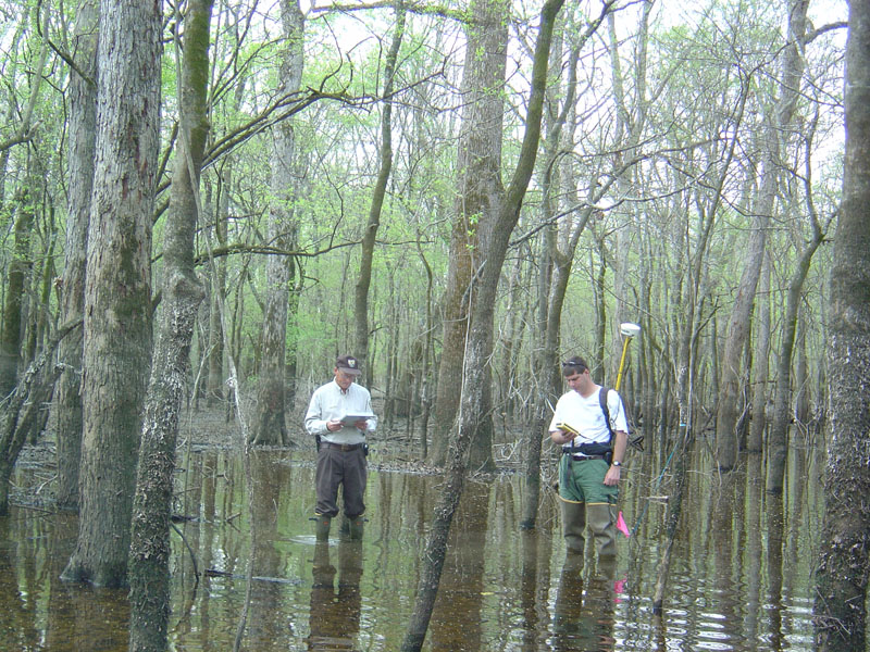
Description:
Bottomland Hardwood Forest of predominantly broadleaf deciduous trees over 20 feet in height with a few Cypress (narrowleaf deciduous) trees present. Semi-permanent water is present in pockets for most of the year. Waterline from spring (March and April) flooding of the Lower White River is evident at about 4 feet above the water surface.
|
Conditions: Spring flooding has receded leaving pools of standing water in low areas and in swales between sand ridges on the floodplain.
|
| Dominant Plants: |
|
Scientific Name: |
| Water Tupelo |
|
Nyssa aquatica |
| Green Ash |
|
Fraxinus pennsylvanica |
| Water Hickory |
|
Carya aquatica |
|
|
Disturbances: None |
|
Comments: |