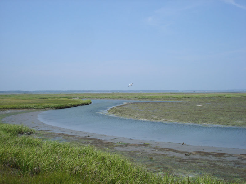
Wallops Island Information
| Wetland Category: | Flats & Beaches | |
| NWI Classification: | E2US3N |
| Latitude: | 37.935762 | Longitude: | -75.412238 |
Image Data |
||
| Date: | 08/31/2008 | |
| Direction: | North | |
| State: | Virginia | |
| Country: | USA | |
| Location: | Wallops Island | |
| Author(s): | Larry Handley | |
| Affiliation: | USGS, Mid-Continent Geographic Science Center | |
|
|  08/31/2008 |  08/09/2012 |  08/08/2012 |  09/19/2014 |  09/19/2014 |
|
Description:
Estuarine intertidal mud flat regularly flooded on a daily basis. |
||
|
Conditions: Tide is out. Water is confined to tidal channels. |
||
|
|
||
| Disturbances: None observed | ||
| Comments: |