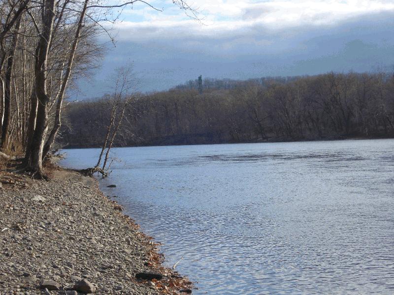
Delaware River - Washington's Crossing Information
| Wetland Category: |
|
Open Water |
| NWI Classification: |
|
R3UB1H |
| Latitude: |
40.341957 |
|
Longitude: |
-74.941907 |
Image Data |
| Date: |
|
11/24/2012 |
| Direction: |
South West |
| State: |
New Jersey |
| Country: |
USA |
| Location: |
South of Lambertville on New Jersey 29 |
| Author(s): |
larry handley |
| Affiliation: |
Government |
|
| 
11/24/2012 | | |
|
|
Description:
Riverine channel of Delaware River; permanently flooded; very little floodplain; cobble-gravel bottom evident in this section of the river.
|
Conditions: Normal water flow. Water marks on vegetation along bank show that Hurricane Sandy rain and snowmelt raised water about 3 feet higher in channel three weeks previously.
|
|
|
Disturbances: |
|
Comments: |