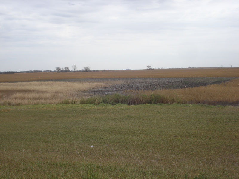
Northern Prairie Pothole Information
| Wetland Category: |
|
Fresh Marsh |
| NWI Classification: |
|
PEM1Cf |
| Latitude: |
45.969810 |
|
Longitude: |
-98,527815 |
Image Data |
| Date: |
|
10/22/2014 |
| Direction: |
West |
| State: |
North Dakota |
| Country: |
USA |
| Location: |
South of Ellendale, ND on US Hwy 281 |
| Author(s): |
Larry Handley |
| Affiliation: |
Scientist |
|
| 
10/22/2014 | | |
|
|
Description:
Palustrine emergent wetland of persistent cattail seasonally flooded that is farmed to the line of saturation or inundation.
|
Conditions: Drier year has allowed farming to lower level within pothole. Emergent herbaceous vegetation and some open water occupy lowest part of pothole.
|
| Dominant Plants: |
|
Scientific Name: |
| Cattail |
|
Typha spp. |
| Sedge |
|
|
| Unknown emergent |
|
|
|
|
Disturbances: Adjacent farming |
|
Comments: |